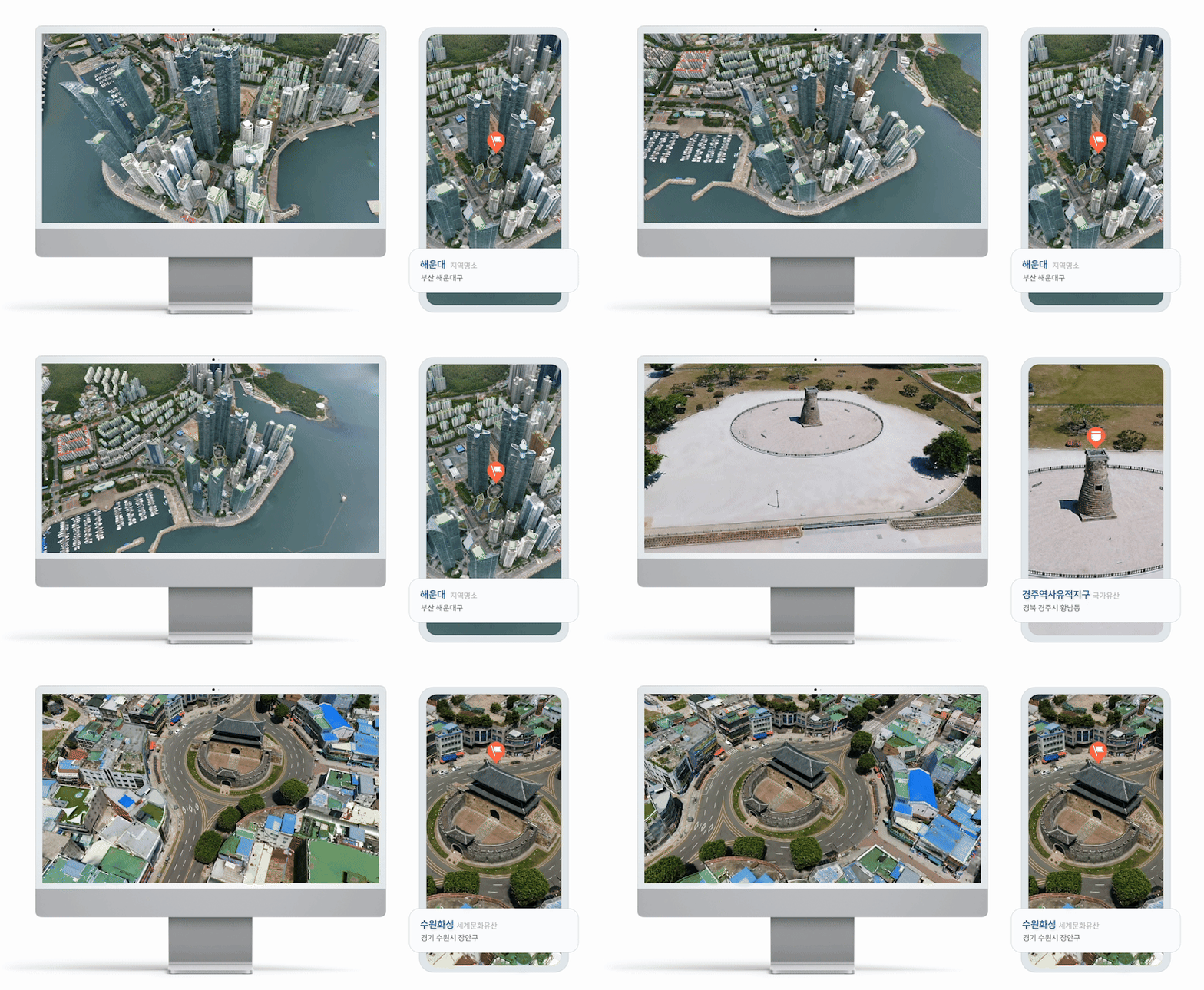
NAVER Map has introduced Flying View 3D, a feature that allows users to vividly explore major landmarks across Korea in three dimensions. NAVER LABS applied its NVS (Novel View Synthesis) technology to create free-viewpoint videos of various locations, including Gyeongju Historic Areas, COEX in Seoul, Songdo Central Park in Incheon, Jeonju Hanok Village, and Haeundae in Busan.
Experience Any Viewpoint You Want
NVS is an AI technology that learns by using real images captured from multiple locations to generate new viewpoints that were never actually filmed.
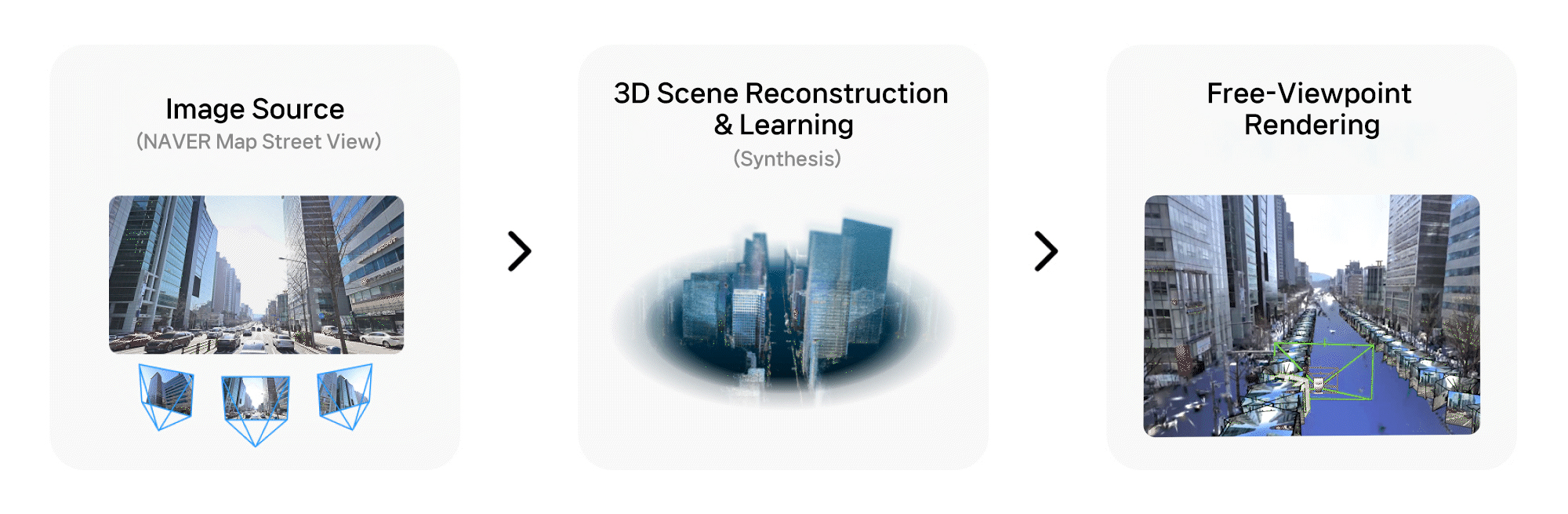
Flying View 3D uses footage captured by drones and P1 street-view vehicles, enabling users to view city landmarks from various angles and positions. Unlike traditional street views or aerial imagery, where the viewing path and camera angles are fixed, NVS allows users to move freely across the city as if they were flying through it. This advancement has greatly enhanced the visual immersion and realism of NAVER Map’s 3D services.
The NVS used in these landmark videos features the following technical achievements.
① Integration of Heterogeneous Sensor Data
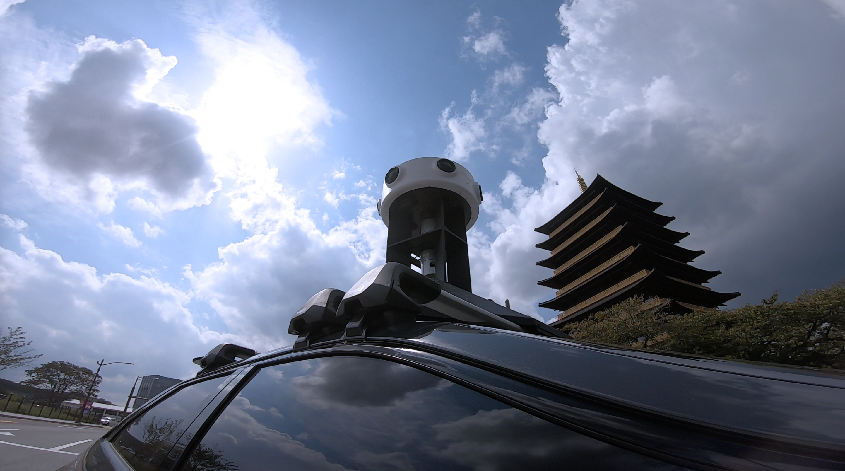
Panoramic Mapping System, P1
To reproduce landmarks from a wider variety of perspectives, videos captured by drones and street-view vehicles (P1) were used together.
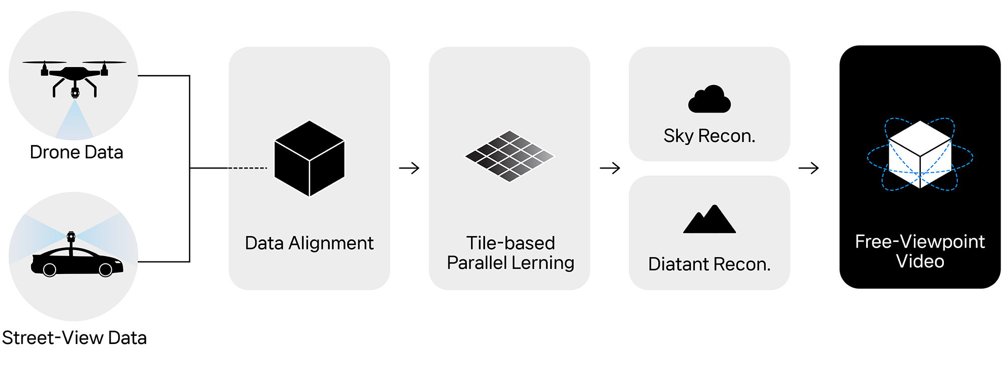
However, the two data sources differ greatly in resolution and field of view, making direct alignment difficult. To address this, NAVER LABS performed step-by-step 3D reconstruction for each dataset and then integrated them into a unified coordinate system using its proprietary alignment algorithm. As a result, aerial and ground footage transition seamlessly, creating a continuous and coherent spatial representation.
② City-Scale Optimization for Large-Area Learning
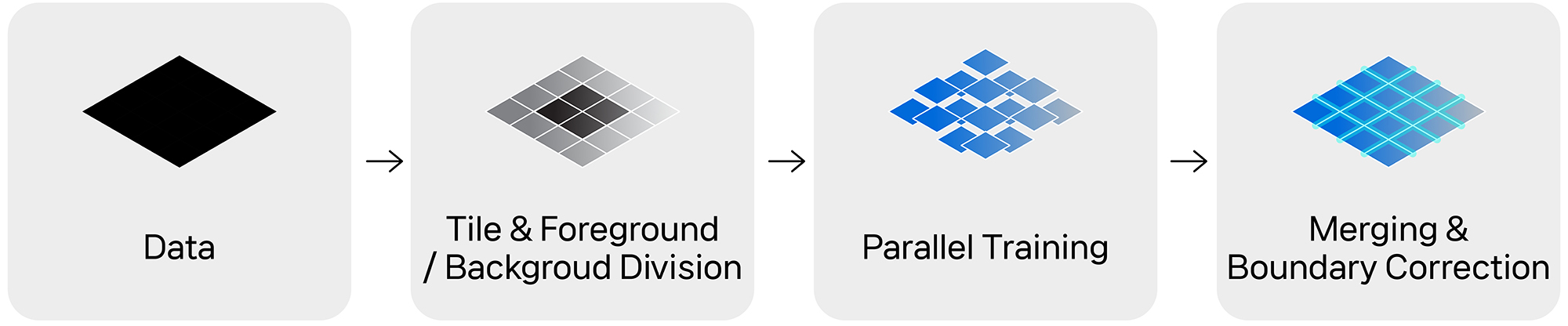
Training NVS models on an entire city requires enormous GPU memory and time. To overcome this, NAVER LABS divided the space into small tile units and processed them in parallel. Foreground areas such as buildings and roads, where users focus their attention, were trained with fine-tuned parameters, while backgrounds used lighter parameters for efficiency. An automatic boundary correction system ensures smooth transitions between tiles. This optimization enabled the construction of a large-scale NVS pipeline capable of learning and rendering city-level 3D data efficiently while maintaining high visual quality.
③ Realistic Rendering of Sky and Distant Backgrounds
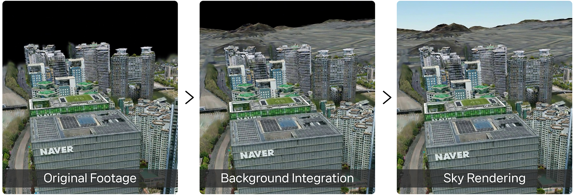
Areas with insufficient visual data, such as the sky or a distant background, can appear distorted or incomplete. To resolve this, NAVER LABS combined satellite imagery with Digital Elevation Model (DEM) data to recreate natural topography. NAVER LABS also applied an atmospheric scattering model so that lighting and colors change dynamically with the sun’s position, time of day, and weather conditions. This realistic background blends seamlessly with 3D imagery, resulting in scenes that look natural, detailed, and deeply immersive, as if they were actually filmed.
Based on the technological features described above, the actual production process can be summarized as follows.
Unlike conventional methods bound to pre-recorded routes, NVS allows the rapid generation of new paths and viewpoints without additional filming, offering exceptional scalability and efficiency. NAVER LABS’ NVS pipeline is also capable of efficiently training massive city-scale datasets, enabling more realistic and immersive experiences to be delivered through a wider range of NAVER services in the future.