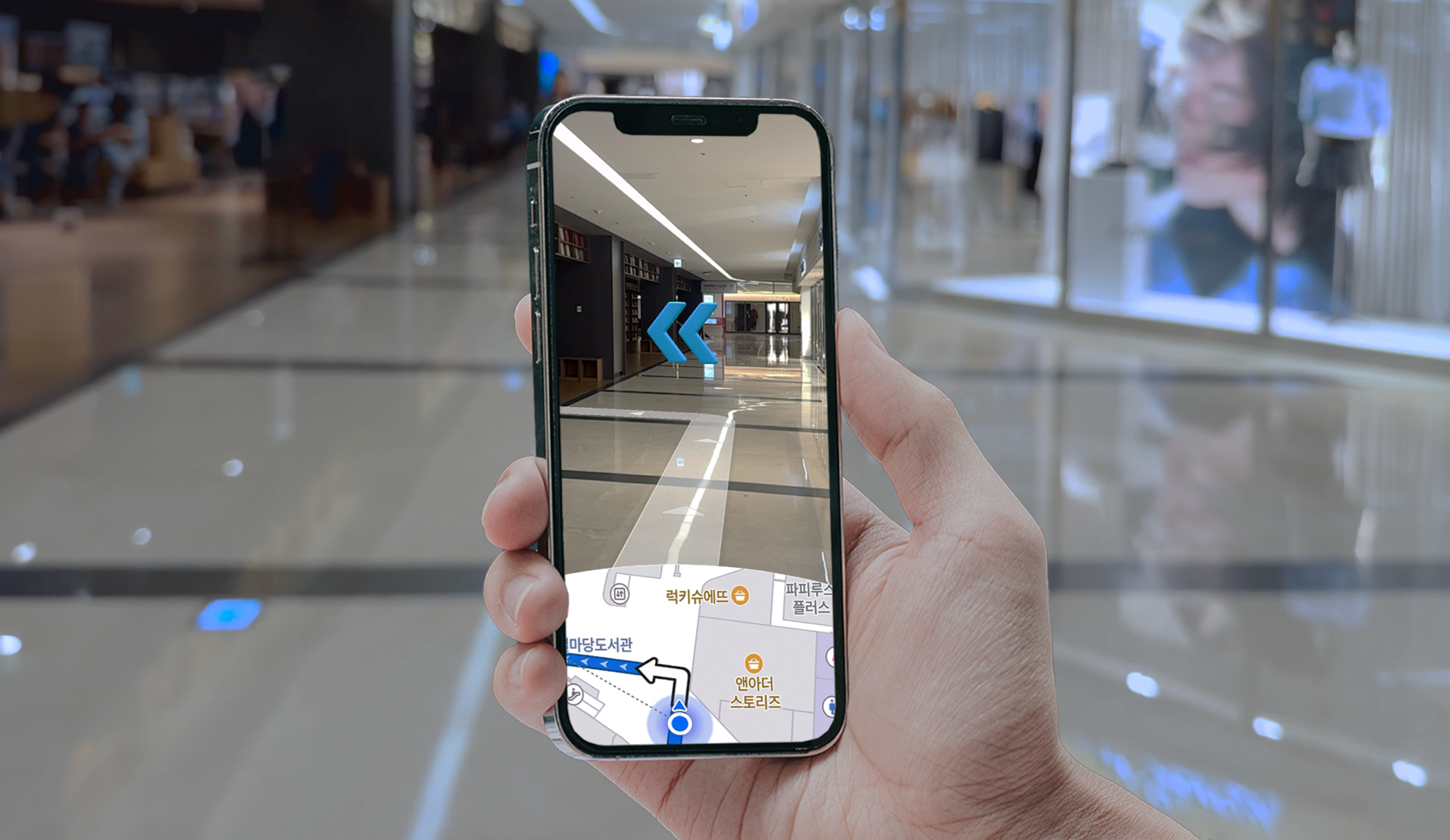
NAVER LABS’ spatial AI technology now powers the indoor AR navigation feature of the NAVER Map app. Its first application site is COEX, one of Korea’s largest and most complex commercial spaces, where navigating through intricate structures and heavy foot traffic can be a major challenge.
In environments where GPS is limited, the key lies in providing real-time positioning and route guidance amid stores, facilities, and crowds.
ARC eye: Precise Indoor Positioning
Every journey begins with knowing exactly where you are. In indoor spaces where GPS signals can’t reach, this precision comes from the vision-based positioning system, ARC eye.
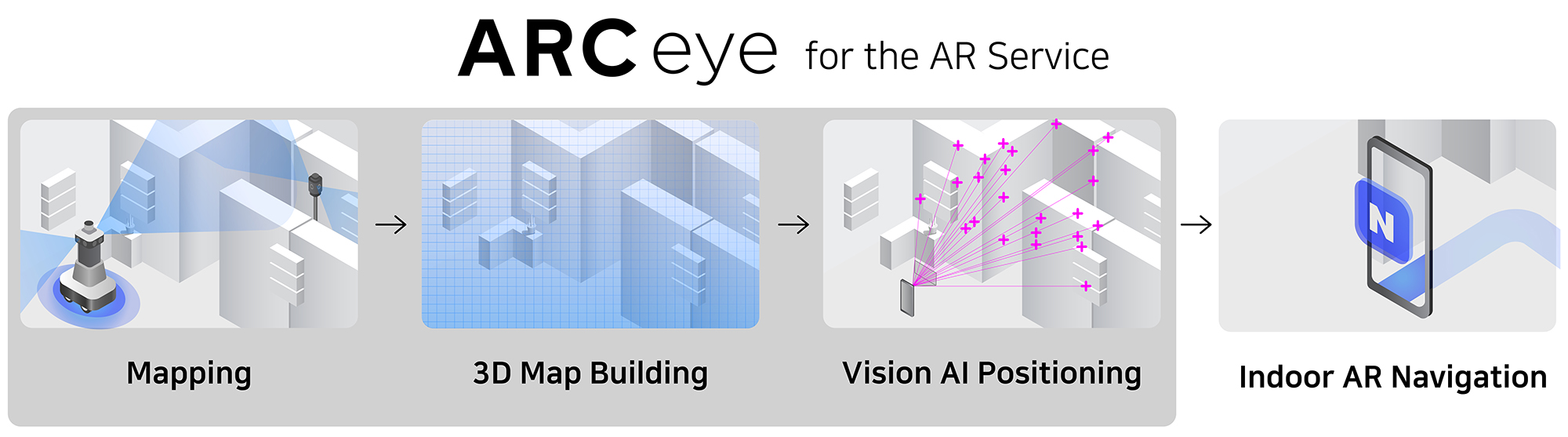
When users scan their surroundings with the NAVER Map app, ARC eye detects their position within 0.3 seconds and maintains an accuracy of up to 15 cm. It continues to operate reliably even under changing lighting conditions, crowds, and various obstacles.
The Digital Twin of a Large-Scale Complex

Seoul COEX Digital Twin
ARC eye operates on a digital twin of the physical environment.
Using its self-developed mapping devices, M2 and T3, NAVER LABS captured and reconstructed a detailed 670,000 m² 3D model of COEX, an area equivalent to about 70 football fields.
This digital twin includes complex terrain such as multi-level structures and stairways, offering a precise and scalable 3D spatial foundation.
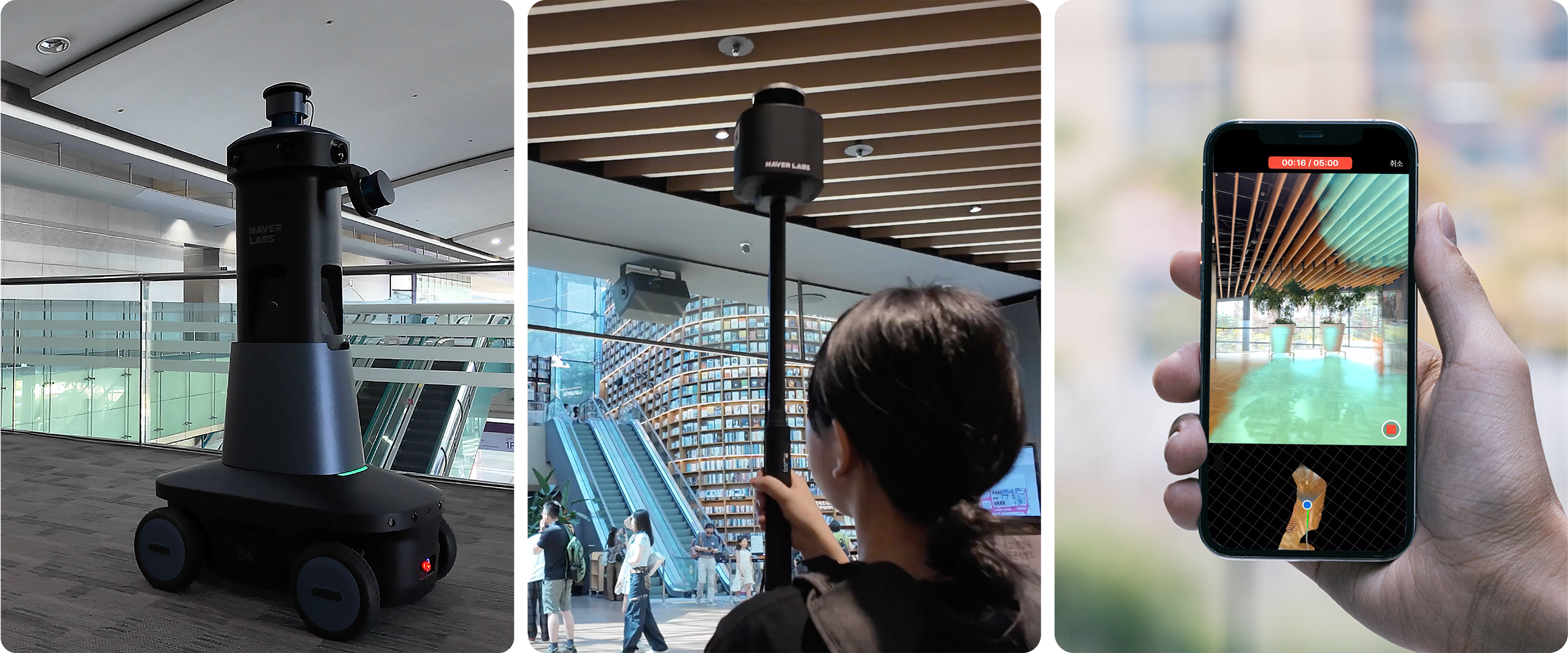
Various Mapping Devices (from left: M2, T3, ARC eye Scan App)
With the ARC eye Scan App, users can also update environmental changes directly through their smartphone cameras, keeping the spatial data current and dynamic.