NAVER’s spatial intelligence technology helps robots exist in harmony with humans in their day-to-day activities – in order for robots to maneuver safely among people, they need to understand exactly where they are, and what their surroundings look like.
Mapping & Localization
NAVER conducts research on technologies that turn spaces into 3D maps and accurately identify location within those maps.
◾️ Mapping Device
Creating a 3D map starts with precisely measuring the shape and size of a space. For this, NAVER develops its own mapping robots and devices.
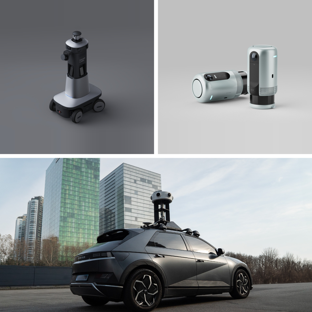
(Top left) M2, (Top right) T3, (Bottom) P1
The M series consists of mapping robots that autonomously navigate indoor spaces to gather spatial data. The T series is a backpack-type mapping device that can also be mounted on other robots, and the P series is a mapping system that could be placed on top of vehicles to capture data from roads and streets.
◾️ Visual Localization
Using these 3D maps, NAVER develops Visual Localization (VL) technology to identify location. VL compares camera images of the surroundings with a 3D map to figure out the current location, enabling accurate positioning even indoors where there is no GPS.
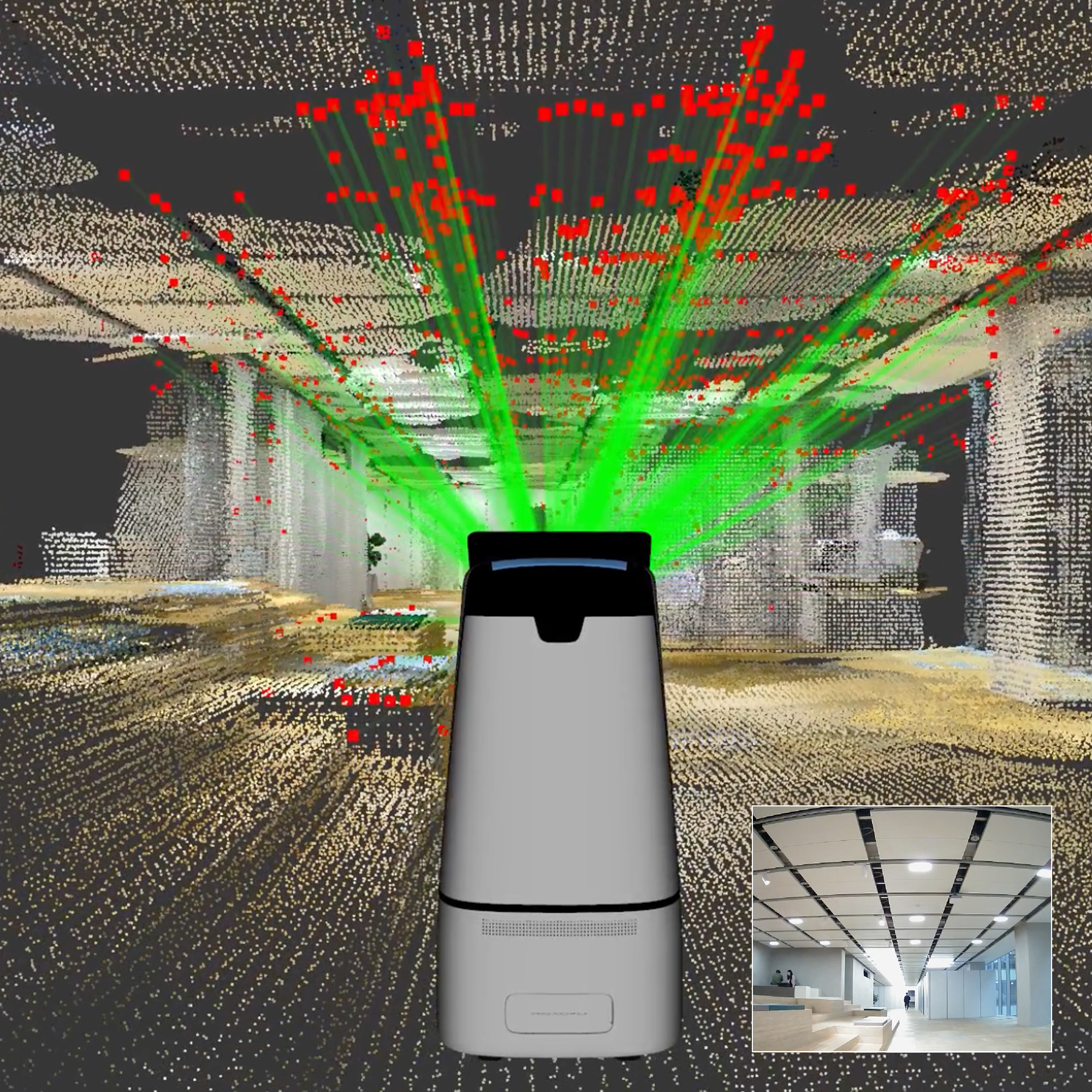
A robot that navigates by identifying its location from images
Robots on the job in 1784 identify their location in real time through ARC eye, a cloud-based localization system powered by VL technology, as they move throughout the building.
Digital Twin
A digital twin is a replica of a real city or building created in the computer-generated virtual world.
◾️ City-Scale 3D Modeling
NAVER uses aerial imagery, AI-based mapping, and large-scale distributed processing technologies to quickly and accurately create 3D models of entire cities.
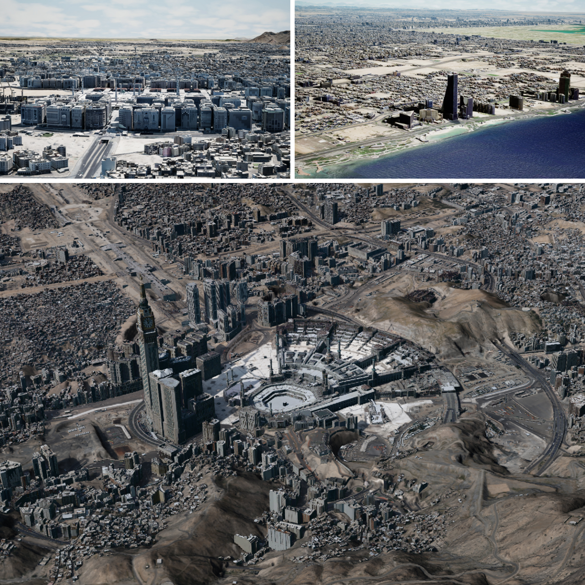
Digital twin of Saudi Arabia built using NAVER LABS technology
◾️ Urban Scenario Simulation
City-scale digital twins are used to test different scenarios virtually before they occur in reality. Challenges in public administration, urban planning, and disaster response can be simulated in advance, with the digital twin platform in Saudi Arabia supporting terrain analysis, visibility analysis, flood simulation, and more.
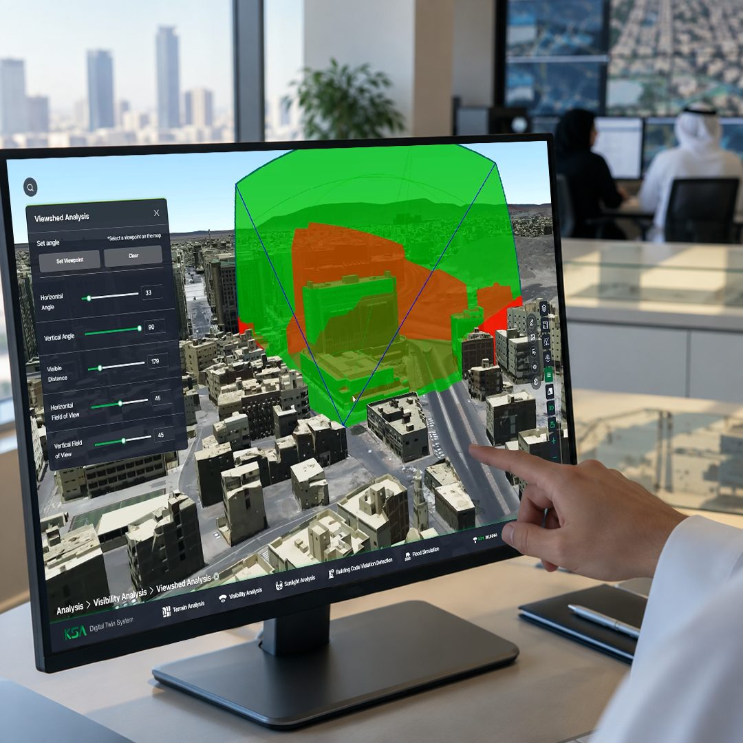
Simulation view of the KSA digital twin platform in Saudi Arabia
◾️ ALIKE
ALIKE is a digital twin solution developed in-house by NAVER LABS. Drones and aircraft are first used to capture images of an entire city, followed by AI reconstructing a detailed 3D city model from the high-resolution aerial images.
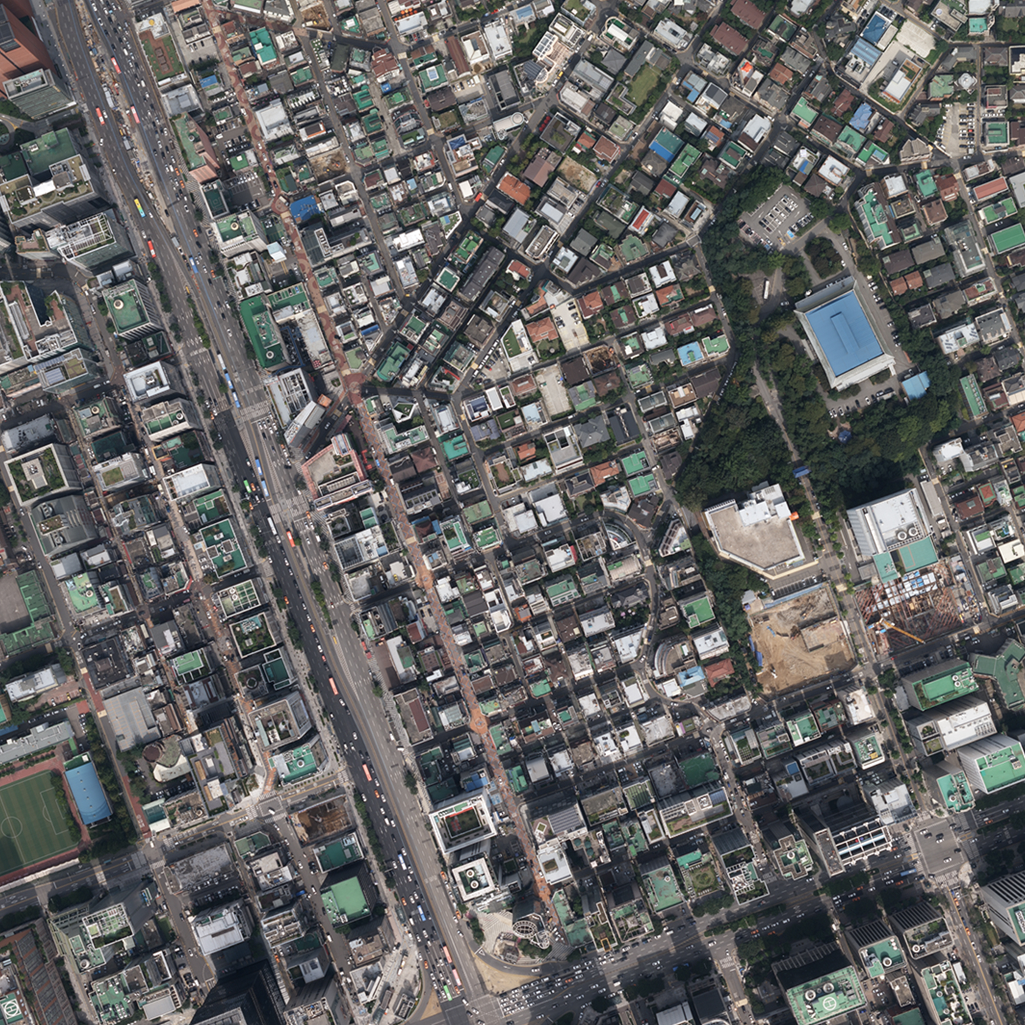
Aerial view of the digital twin of Seoul city
NAVER has built digital twins of entire cities, including Seoul and Saudi Arabia’s Mecca, Medina, and Jeddah, as well as large indoor spaces such as COEX, the National Museum of Korea, and Tokyo Midtown Yaesu.
XR Services
NAVER's spatial intelligence technologies are also making their way into services that people use in their everyday lives.
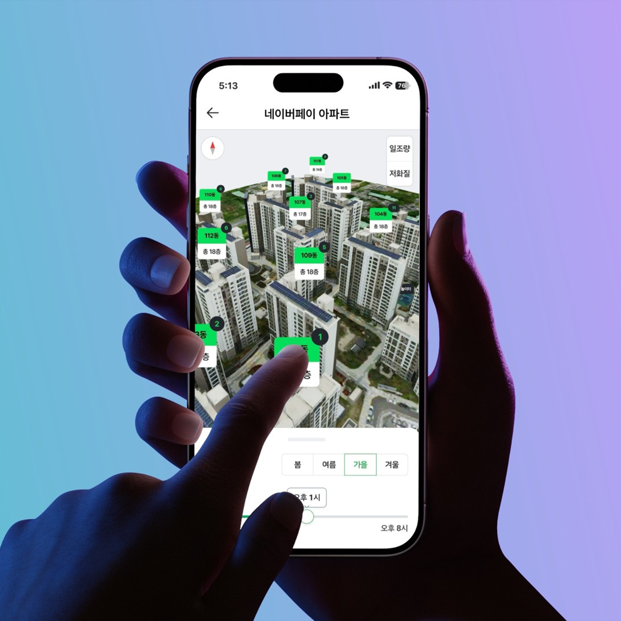
◾️ VR
VR services replicate real-world spaces in a digital environment, allowing users to explore them without having to visit in person. VR property tours and VR complex tours on NAVER Pay Real Estate let users virtually explore apartment complexes and home interiors exactly as they appear in real life.
NAVER Pay Real Estate VR Tour >
◾️ AR
NAVER’s AR navigation uses VL technology, which identifies location by comparing what the camera sees with a 3D map. As a result, it works accurately even indoors where GPS signals are weak, and can guide users through hard-to-navigate indoor spaces like shopping malls and subway stations.
◾️ 3D Panorama
NAVER Map offers 3D panorama services based on digital twin technology. Street View 3D reconstructs streets and buildings in 3D using data collected by the P1 mapping system. NAVER also applies Novel View Synthesis (NVS), an AI technology that generates scenes even from angles that were never actually captured, to offer Flying View 3D, which shows major landmarks from an aerial perspective, and Store View 3D, which allows users to virtually look around inside stores.
NAVER LABS Technology Research Updates – Physical AI >