On the day before BTS’s concert in Gwanghwamun, a 3D billboard appeared on Naver Map’s Street View.
(S).gif)
By placing a virtual billboard in the plaza and displaying a concert promo video on it, we wanted to offer an experience that felt as if users were walking through the area in advance.
In its early days, Street View was little more than a series of flat images simply stitched together. Today’s Street View 3D, powered by NAVER LABS’ technology, reconstructs buildings and streets in three dimensions based on precise location data. There is plenty that can be done in this new space, and this 3D billboard was one such attempt.
Turning Space Itself into an Interface
Let us take a closer look at the technology behind it. The first step is to collect data in 3D. P1, the panoramic mapping system developed by NAVER LABS, drives along roads and scans the streets. Using cameras and LiDAR sensors, it simultaneously captures panoramic street images and point clouds containing the shape and depth information of a space.
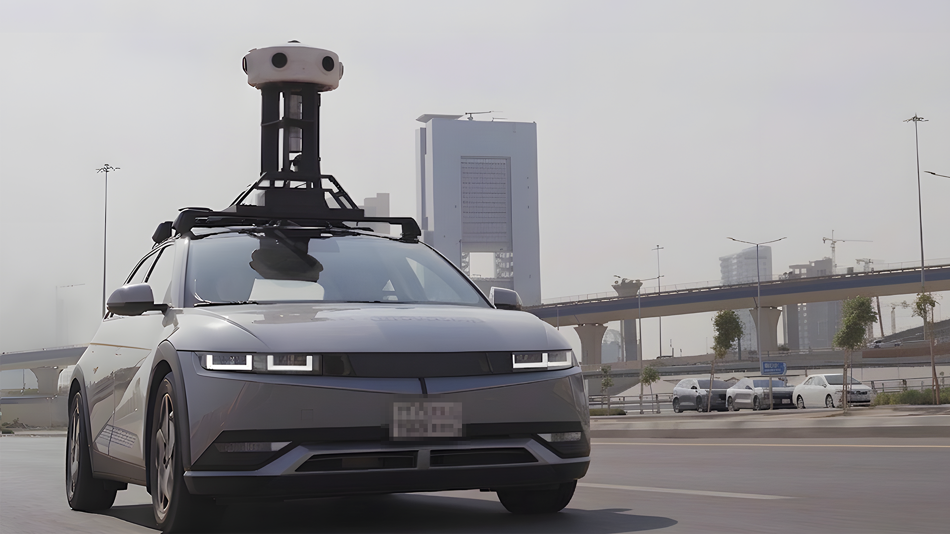
Panoramic Mapping System, P1
The collected data then goes through a registration process and is reconstructed into Street View 3D, a three-dimensional representation of the real world. In this process, building facades, road boundaries, and sign locations are assigned 3D coordinates. This ultimately makes it possible to place virtual content at precise locations in real spaces.
This content can be aligned naturally to match the curves and corner angles of a building’s exterior, while perspective and depth change according to the user’s point of view. Thus, it is not simply an image overlaid on a screen, but an object that exists in the actual space.
The Many Uses of P1 Data
This experiment was fun in itself, but the Street View 3D data collected by P1 is being used in far more diverse ways.
For example, this data serves as excellent training material for AI. Once AI learns from it, it can generate 3D scenes from new angles that were never actually captured. This is called Novel View Synthesis (NVS), and it is now directly applied to Flying View 3D on Naver Map.
Its value even extends beyond services and into academic research. The Street View 3D data was also used in the Seoul World Model project conducted jointly with KAIST, showcasing how it is expanding into research aimed at understanding reality on a larger scale.
Thanks to the data’s high precision and rich information, it is also used in robot navigation research at NAVER LABS. A map once built for people is now becoming a map for machines, too.
The reason there is so much we can do with it is simple: the world we live in is three-dimensional.